How Does GPS Know Where You Are?
Your phone finds itself by timing radio signals from satellites about 20,000 km overhead. Atomic clocks, a fourth satellite and a correction from Einstein make it work, and India now runs its own system called NavIC.
 By Sushant Kataria· 8 min read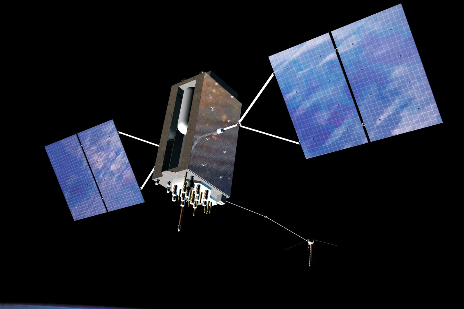
GPS knows where you are by measuring how long radio signals take to reach your phone from several satellites orbiting about 20,200 km above Earth, then converting those travel times into distances. With distances to at least four satellites, your receiver can work out its position in three dimensions and correct its own clock at the same time.
That is the whole trick, and it is both simpler and stranger than most people expect. Your phone never sends anything to the satellites. It only listens, and every map pin, food delivery and cab ride you have tracked depends on a stopwatch accurate to billionths of a second.
A constellation that only broadcasts
The Global Positioning System is owned by the United States government and operated by the US Space Force. Its design calls for a baseline of 24 satellites spread across six orbital planes, though around 30 are usually in service so there are spares. Each one circles the Earth twice a day at an altitude of roughly 20,200 km.
From almost anywhere on the planet, with a clear view of the sky, at least four of them are above the horizon at any moment. Each satellite continuously broadcasts two things: the exact time on its onboard clock, and precise information about where it is in its orbit. Ground stations, coordinated from a master control station in Colorado, track the satellites and upload fresh orbit data so those broadcasts stay accurate.
Because the satellites only transmit, there is no limit on how many people can use GPS at once. A billion phones cost the system nothing extra.
Turning time into distance
Radio signals travel at the speed of light, about 300,000 km per second. If your phone knows when a signal left a satellite and when it arrived, the difference tells it how far away that satellite is. A delay of about 67 milliseconds, for example, means the satellite is about 20,000 km away.
One distance is not enough. It only says you are somewhere on an enormous imaginary sphere centred on that satellite. A second satellite narrows it to the circle where two spheres meet. A third leaves two possible points, and one of them is usually far out in space or moving impossibly fast, so it can be discarded. This method is called trilateration.
The catch is precision. Light covers about 30 cm in a single nanosecond. A timing error of one microsecond, a millionth of a second, would put you about 300 metres off. The satellites solve their side of this problem with atomic clocks, using caesium and rubidium standards that lose almost no time over years.
Why you need a fourth satellite
Your phone, however, does not carry an atomic clock. It has a cheap quartz oscillator that drifts far too much to time signals to the nanosecond.
The solution is elegant. The receiver treats its own clock error as one more unknown. There are now four unknowns: east and west, north and south, altitude, and the time offset. Four unknowns need four equations, so the receiver uses signals from four satellites and solves them together. In doing so, your phone ends up with a near-atomic-quality reading of the time as a side effect.
This is why GPS is also one of the world's great clocks. Mobile networks, stock exchanges, banks and power grids use GPS timing to keep their systems synchronised.
The Einstein correction
GPS is one of the few everyday technologies that would fail without relativity.
Einstein's special relativity says a moving clock ticks slower. The satellites travel at about 14,000 km/h, which makes their clocks lose roughly 7 microseconds a day compared with clocks on the ground. General relativity says clocks in weaker gravity tick faster. Twenty thousand kilometres up, that effect makes them gain about 45 microseconds a day.
The net result is that a GPS satellite clock runs about 38 microseconds a day fast. That sounds trivial, but at the speed of light it adds up to errors of around 10 km a day. Engineers therefore set the satellite clocks to tick slightly slow before launch, so that once in orbit they match time on the ground. Timing light this precisely is a powerful measuring tool well beyond navigation: it is also how scientists know why the Moon is drifting away, by bouncing lasers off mirrors left by Apollo astronauts.
From a Cold War project to your pocket
The idea grew out of the space race. After the Soviet Union launched Sputnik in 1957, researchers at Johns Hopkins University's Applied Physics Laboratory found they could work out the satellite's orbit from the shift in its radio signal. Reverse the logic, and a known satellite could tell you where you were. The US Navy's Transit system, built on that insight, guided submarines from the 1960s.
The US Department of Defense approved what became GPS in 1973, and the first test satellite launched in February 1978. After a Soviet fighter shot down Korean Air Lines Flight 007 in 1983, when it strayed into Soviet airspace, President Ronald Reagan announced that GPS would be made available for civilian use once it was complete. The system reached full operational capability in 1995.
Civilian signals were deliberately degraded at first, a policy called Selective Availability. When the US switched it off in May 2000, civilian accuracy improved roughly tenfold overnight. Car navigation, ride-hailing and location-based apps followed. Today, the US government says a GPS-enabled smartphone is typically accurate to within about 4.9 metres under open sky.
Why your blue dot still wanders
In real life, GPS has to fight its surroundings. Tall buildings block signals and bounce them off glass and concrete, an effect called multipath, which is why your blue dot jumps around in a city centre. The atmosphere also slows signals slightly as they pass through it.
Phones compensate in several ways. They use nearby Wi-Fi networks and mobile towers to get a quick first fix, download satellite data from the internet to save time, and increasingly listen on two frequencies at once to cancel out atmospheric delay. They also no longer rely on GPS alone.
Many skies, many systems
GPS is now one of several global navigation satellite systems. Russia runs GLONASS, the European Union runs Galileo and China completed its global BeiDou network in 2020. Japan operates a regional system, QZSS, that strengthens coverage over East Asia. Most modern phones combine signals from several of these, which means more satellites in view and a faster, steadier fix.
The internet's other hidden backbone runs the opposite way, along the ocean floor rather than through orbit; undersea fibre-optic cables carry almost all intercontinental data, while satellites like these carry position and time.
India's own constellation: NavIC
India's interest in a homegrown system sharpened after the 1999 Kargil conflict, when, as has been widely reported, the country could not obtain the satellite data it wanted from the US for the conflict zone. Depending on another country's military system for navigation was a strategic risk.
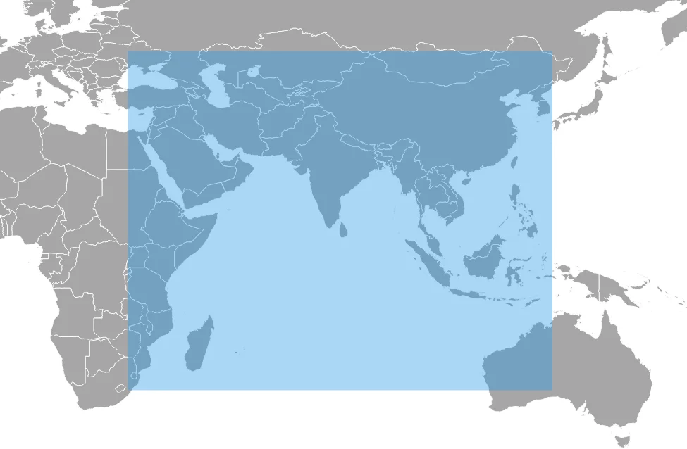
The result is the Indian Regional Navigation Satellite System (IRNSS), built by ISRO and named NavIC (Navigation with Indian Constellation) in 2016. The first satellite, IRNSS-1A, launched in July 2013. Unlike GPS, NavIC is regional: its seven-satellite design uses three geostationary satellites and four in inclined geosynchronous orbits, which keep it high over the Indian Ocean region. It covers India and an area extending about 1,500 km beyond its borders.
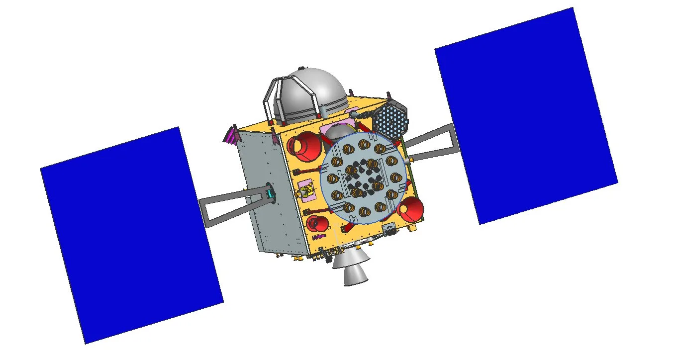
The road has not been smooth. The imported atomic clocks on several first-generation satellites failed, and a replacement satellite, IRNSS-1H, was lost in 2017 when its heat shield did not separate after launch. ISRO's second-generation satellites answer both problems. NVS-01, launched in May 2023, carries an indigenous rubidium atomic clock and broadcasts on the L1 frequency that most smartphones already use. Its successor, NVS-02, became ISRO's 100th launch from Sriharikota in January 2025, though a valve fault stopped it from reaching its planned orbit.
NavIC already does real work. Chipmakers such as Qualcomm added support from 2019, and Apple's iPhone 15 Pro, released in 2023, lists NavIC among its supported systems. NavIC also carries short broadcast messages, which ISRO has used to send weather and cyclone warnings to fishermen at sea. Separately, India's GAGAN system, run by ISRO and the Airports Authority of India, sharpens GPS signals over Indian airspace so aircraft can use them for precise approaches.
The fragile part
Satellite signals reach the ground astonishingly weak, weaker than the background radio noise around them. That makes them easy to jam, and in some regions, easy to fake. Spoofing, broadcasting false signals that trick a receiver into reporting the wrong position, has become a real concern for aviation and shipping. In late 2023, India's aviation regulator, the DGCA, issued an advisory to airlines after reports of GPS spoofing affecting flights over the Middle East.
That vulnerability is one reason countries want their own systems and receivers that cross-check several constellations at once.
The takeaway
Every time a map app finds you in a second, it is listening to satellites thousands of kilometres overhead, timing their signals to billionths of a second and correcting for Einstein along the way. All of it is free to use. Like the QR code, GPS became everywhere because anyone could build on it, and it now quietly underpins navigation, payments, telecom and power, from Los Angeles to Lucknow.